Topography & Implications
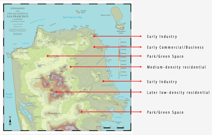
Topography is one force that has shaped land use and development patterns in San Francisco. The flatter land on the east side of the bay was ideal for initial shipping industries and related commerce to locate. Development spread out from here, but the business core remained concentrated in this upper east section of the city—where the land would accommodate large building construction. Some of the eastern border land seen in the map above was not original to the peninsula, but was added through bay infill. While higher density housing sprang up around these early commercial and industrial areas, medium to low density housing began to develop in the hillier parts of the city. The extremely hilly parts near the center of the city were last to develop. The largely low-density housing land use patterns in this area today demonstrate the difficulty of building in these steep hills. The following land use maps will help demonstrate how land use and topography are closely related in San Francisco.
(Source: Urbanlifesigns.blogspot.com; edited to show land use development)
